Forest fire areas in transition
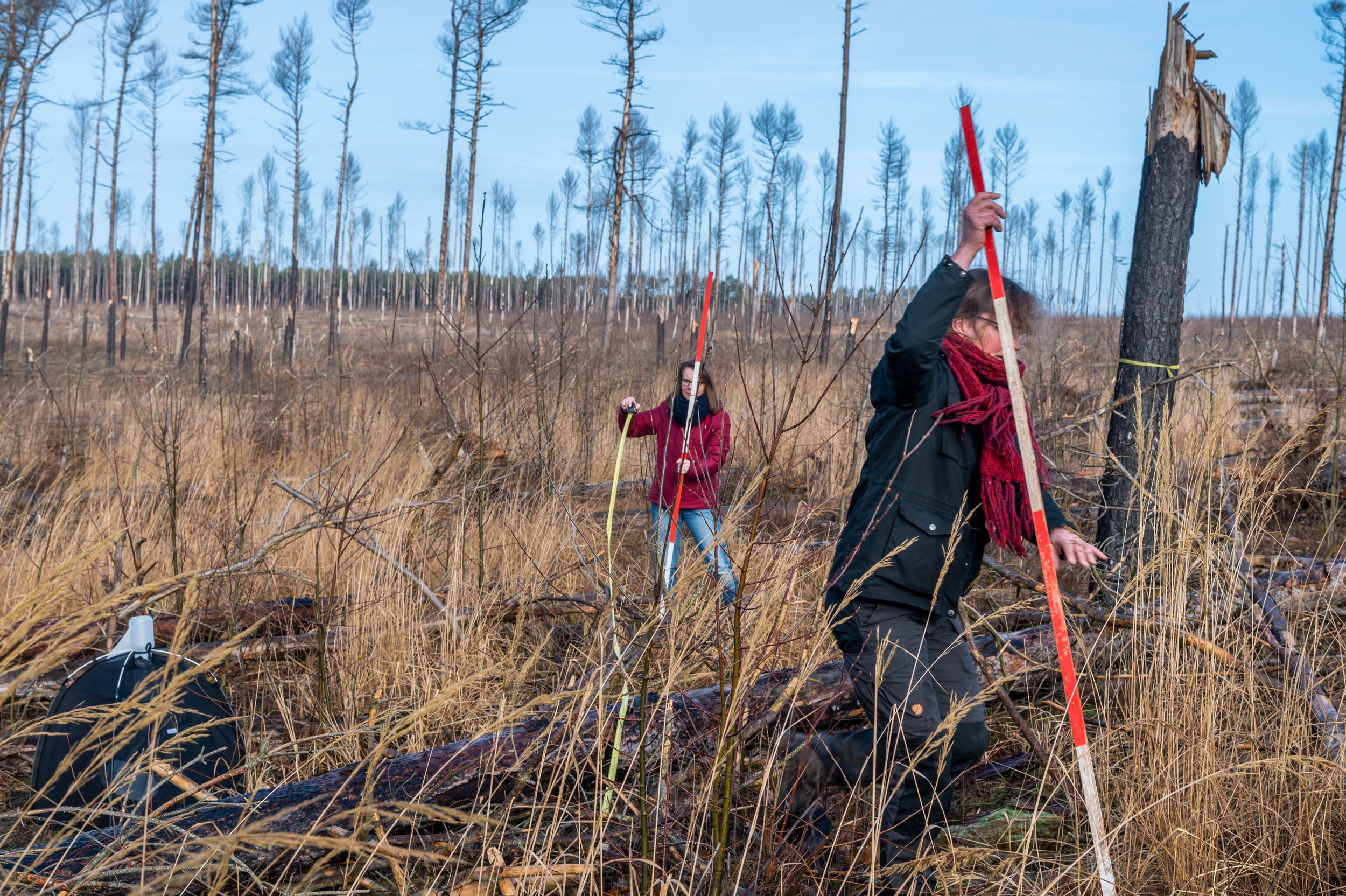
Scientific photo monitoring
The Wilderness Foundation carries out scientific photo monitoring. The same section of a plot is photographed four times a year in each study area. The monitoring accompanies the data collection of the network partners and documents the development after the fires over the years.
Development on a clear-cut area: Pine loses, poplar wins
Area J2 in the private forest area Treuenbrietzen
Clear cutting, tillage (ploughing), pine (planted)

(Foto © Dr. Tilo Geisel 2020)
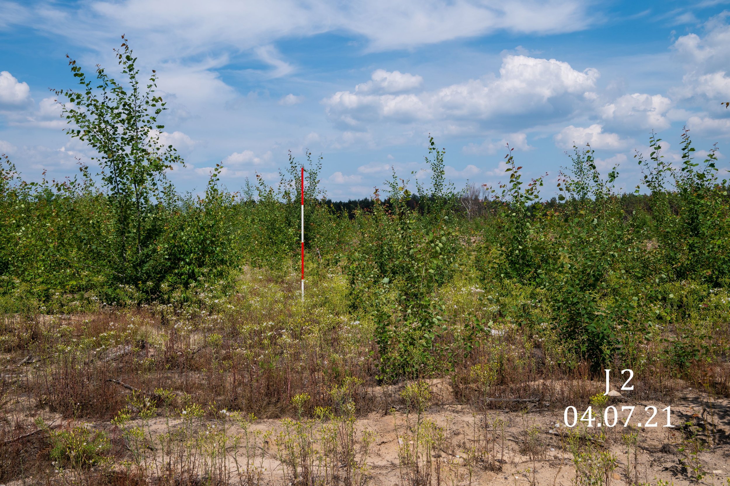
(Foto © Dr. Tilo Geisel 2021)
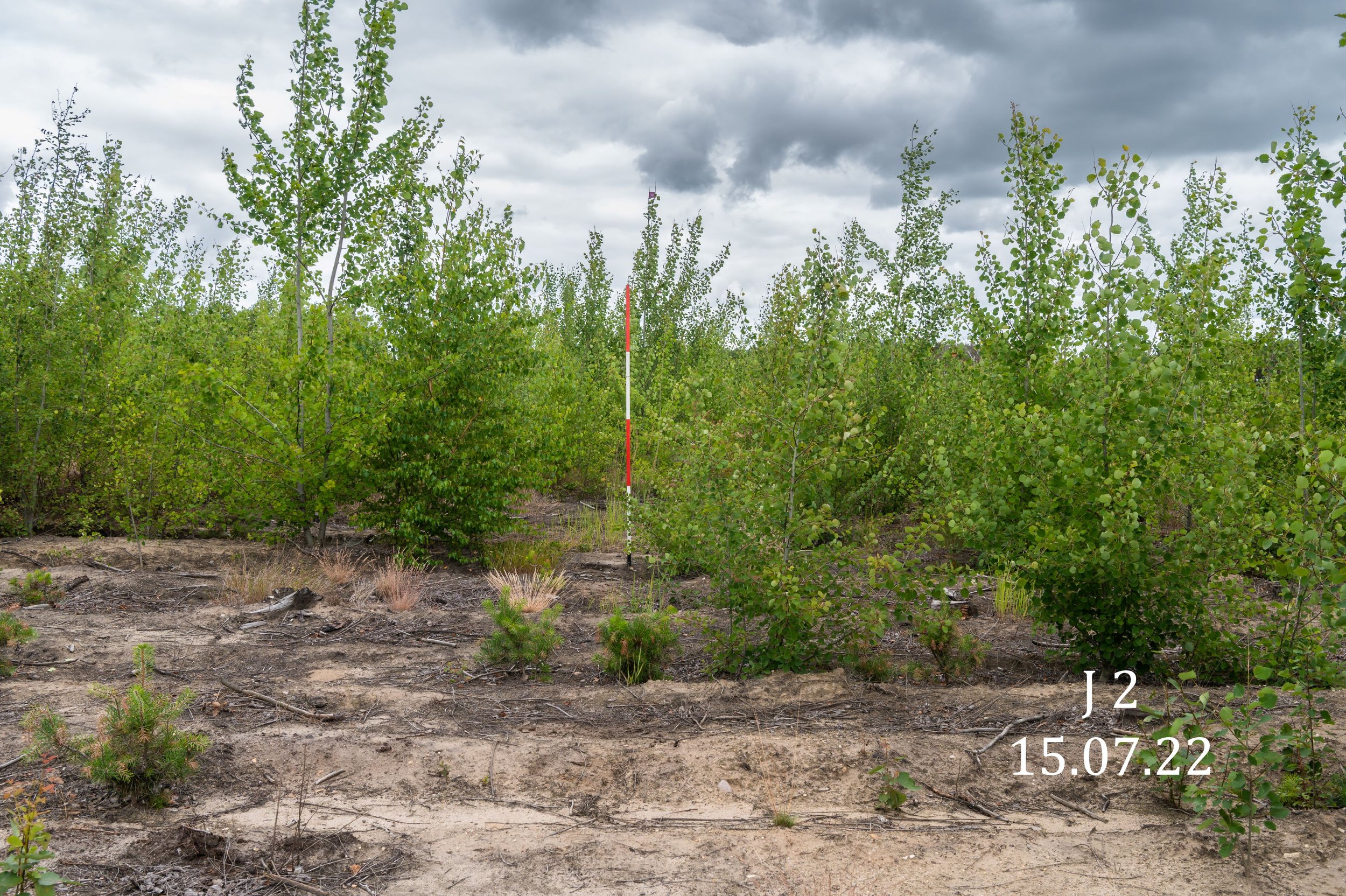
(Foto © Dr. Tilo Geisel 2022)
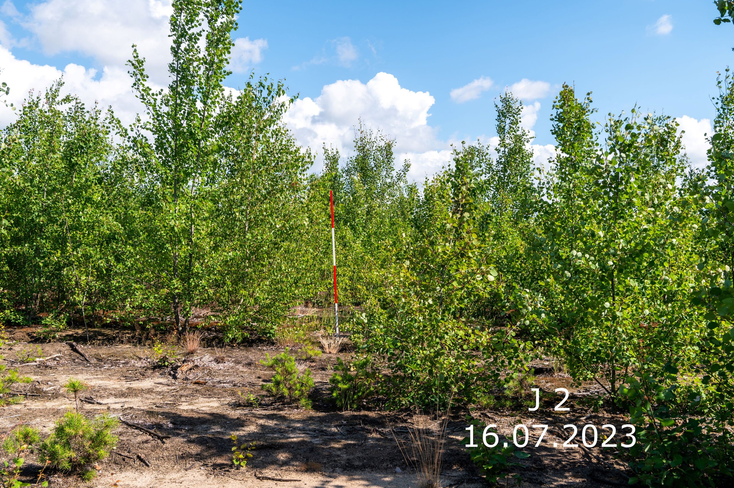
(Foto © Dr. Tilo Geisel 2023)
Natural succession in the total forest reserve: four years after the fire, most of the trees have fallen down
Area U9 in the area of the Wilderness Foundation
Natural regeneration through birch

(Foto © Dr. Tilo Geisel 2020)
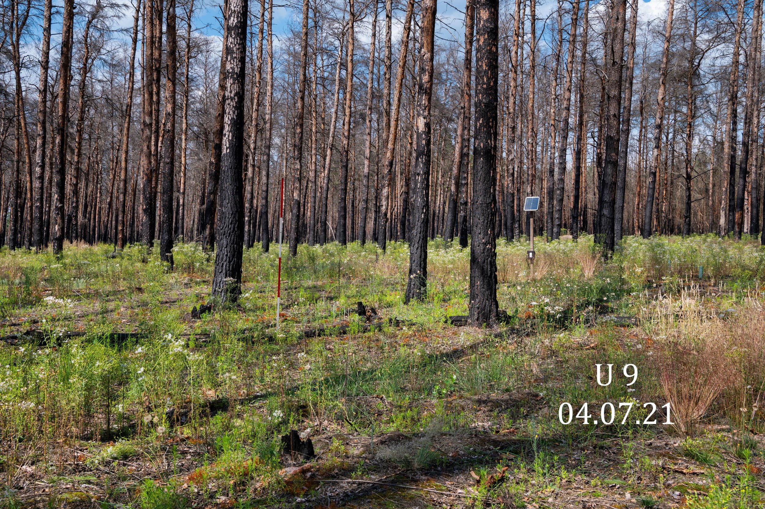
(Foto © Dr. Tilo Geisel 2021)
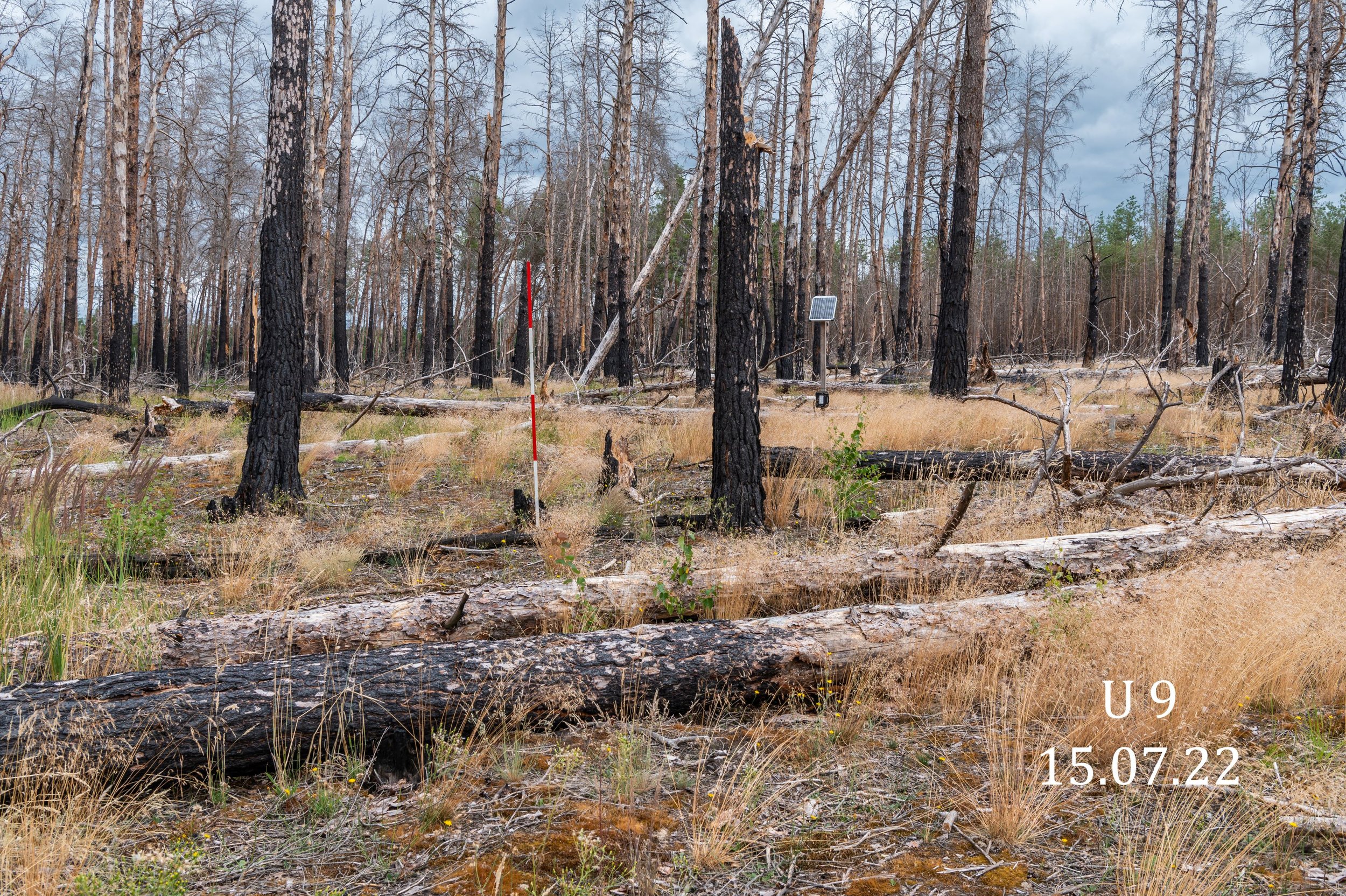
(Foto © Dr. Tilo Geisel 2022)
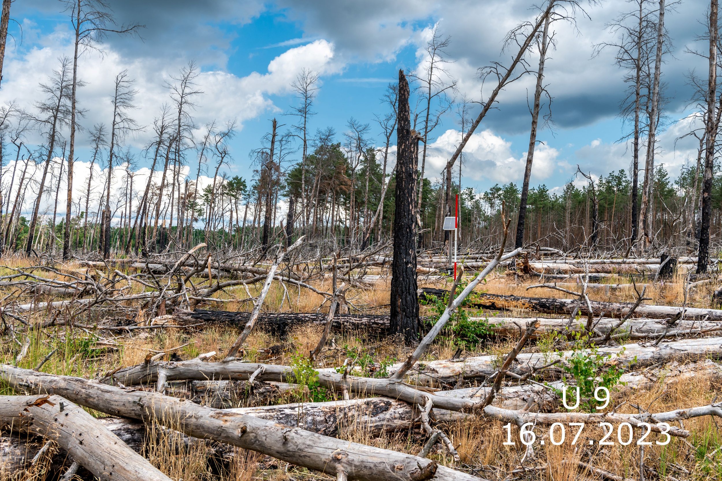
(Foto © Dr. Tilo Geisel 2023)
Development on a reference site: the picture hardly changes
Area Z2 in the area of the Wilderness Foundation
Existing pine stand
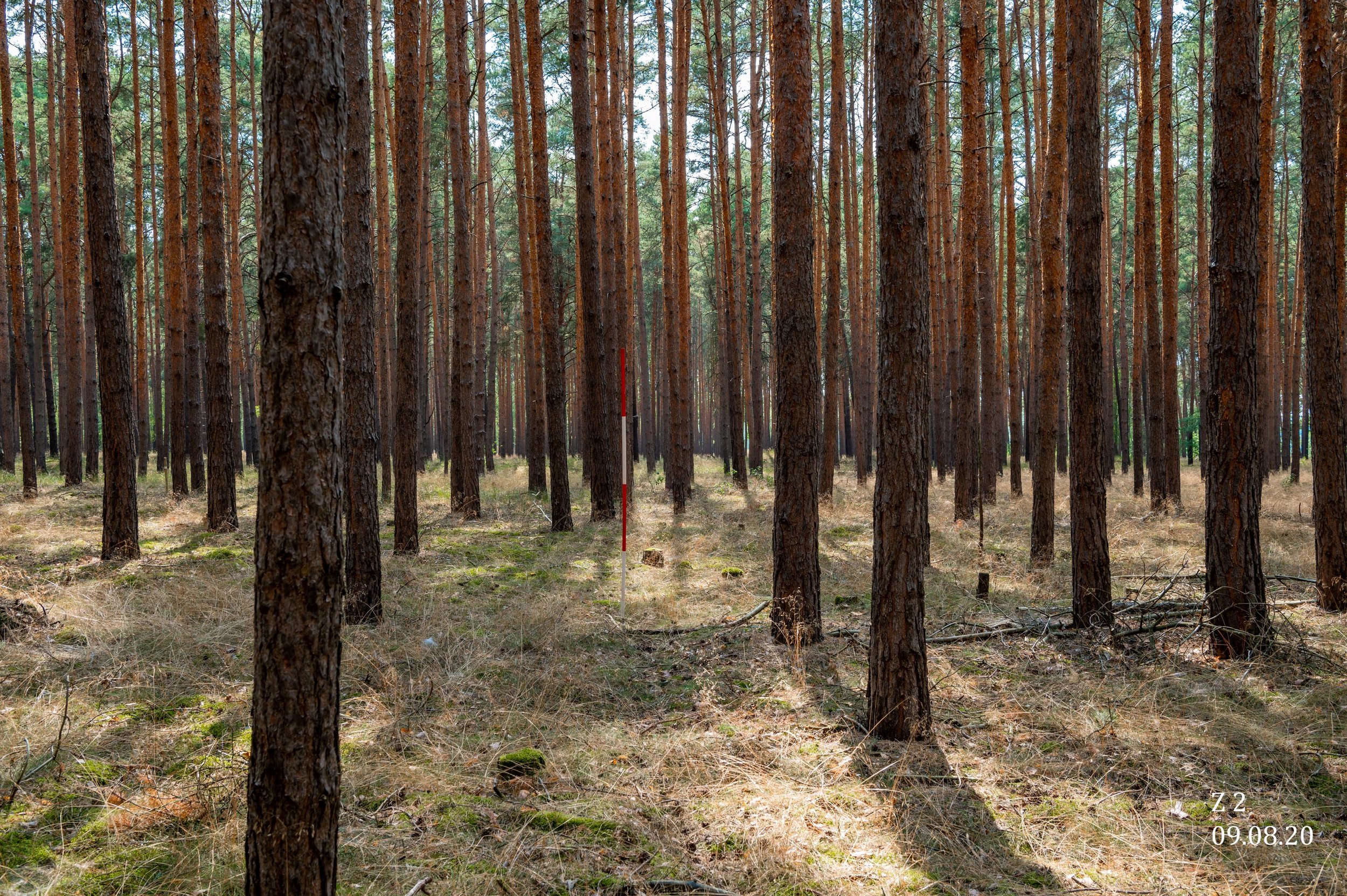
(Foto © Dr. Tilo Geisel 2020)

(Foto © Dr. Tilo Geisel 2021)
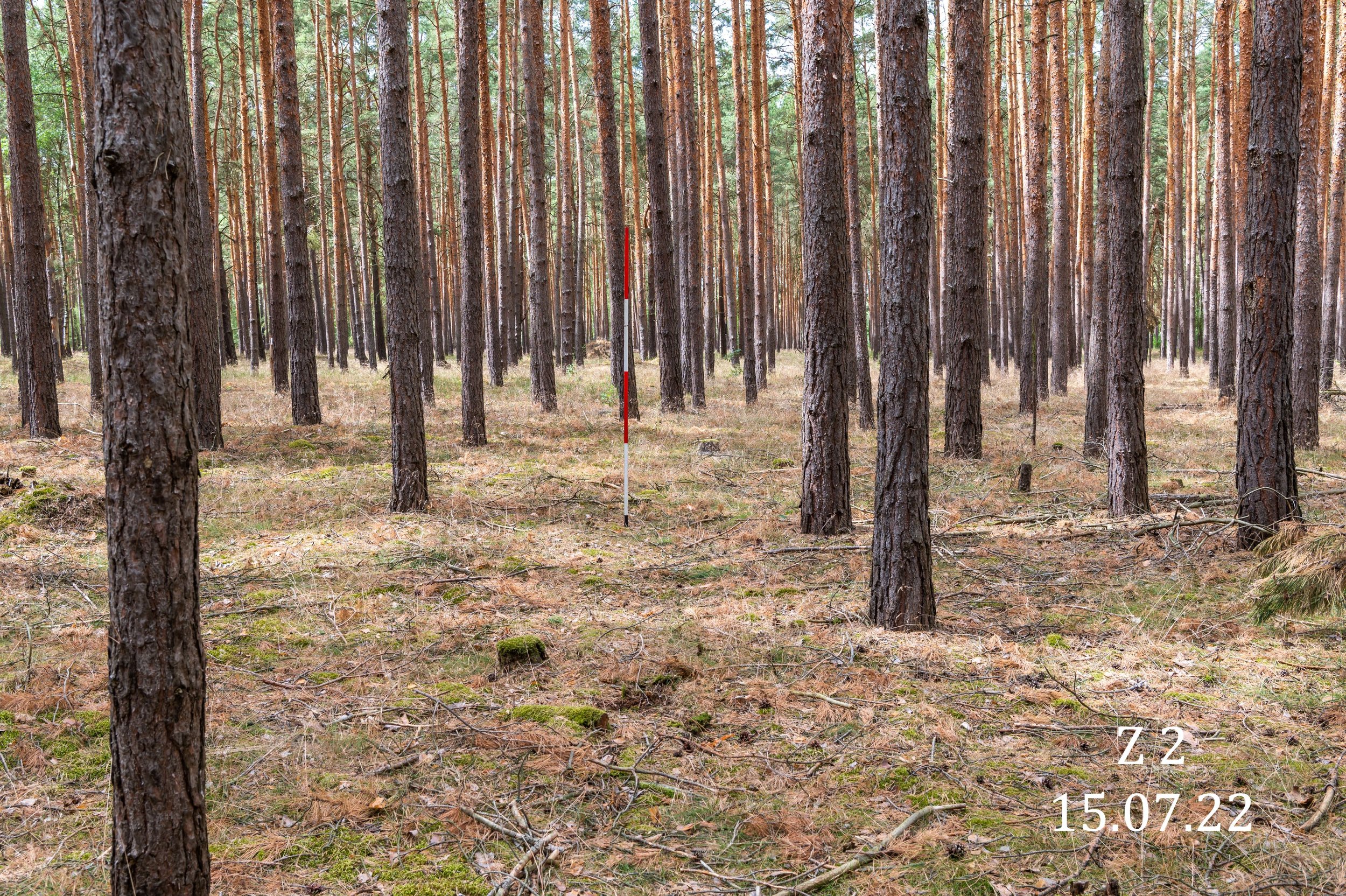
(Foto © Dr. Tilo Geisel 2022)

(Foto © Dr. Tilo Geisel 2023)